Wingman Wednesday – Sky Commander
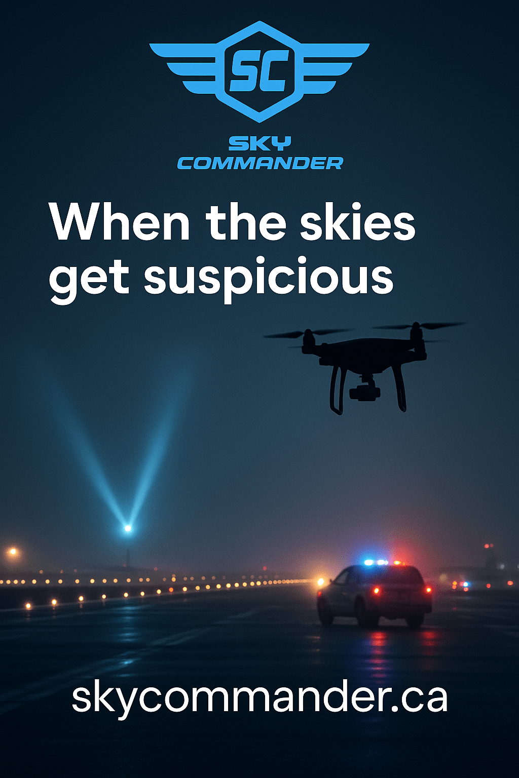
Why this matters today: In just the last 24 hours, two major Scandinavian airports temporarily halted traffic due to “unidentified drones,” causing diversions and delays while police scrambled to respond. Events like this are exactly where compliant pilots can get swept into suspicion. Reuters+1
Quick Summary (what you’ll get here)
- What these “mystery drone” headlines mean for you (and why misidentification happens)
- Exactly what to carry and log so you can prove compliance on the spot
- How to handle authorities and the public without making things worse (scripts included)
- Insurance & legal exposure in Canada (what Transport Canada actually says)
- An incident response checklist you can use the minute a report pops up nearby
The pattern: sensational headlines, few facts — and collateral suspicion
When airports, military bases, or city centers report “drone sightings,” the initial reports are often sparse, unverified, and emotionally charged. Some cause massive disruption even when no operator is ever found (e.g., Gatwick, 2018). Airlines alone reported >£15 million in costs; the airport’s direct cost was ~£1.4 million. The investigation closed without charges. The Guardian
In the past year, U.S. military installations reported a sharp rise in drone incursions over bases (roughly 420 from Sep 2024 to Sep 2025, up from ~230 the prior 12 months)—a mix of better detection and more activity. Translation: more reports and alarms, more scrutiny on anyone flying nearby. The War Zone
Bottom line: Even if you’re fully legal, misidentification is a business risk. Your defense is preparation, documentation, and professional conduct.
Your risk profile in Canada (2025 reality check)
- Regulatory landscape moved in 2025. Transport Canada expanded privileges (e.g., some lower-risk BVLOS for certified operators; new medium-drone rules). With more ops comes more scrutiny and higher penalties for getting it wrong. Transport Canada
- Fines increased. TC flags higher monetary penalties for violations under Part IX; maximums vary by offense and context. (See TC’s guidance and AIM reference.) Transport Canada+1
- Insurance isn’t mandatory for all ops, but Transport Canada explicitly recommends public liability insurance—and many home/tenant policies don’t cover drones. (Commercial contracts often require it.) Transport Canada+1
- Authorizations & airspace: Use NAV DRONE / NAV CANADA tools to plan, request, and record controlled-airspace approvals. Nav Canada+1
The “Misidentification Defense Kit” (carry this every flight)
Show-me-now packet (physical or digital):
- Pilot certificate (Advanced if required for your operation) and government ID.
- RPAS registration (for ≥250 g) and aircraft label. Transport Canada
- Flight plan + airspace proof: screenshots/PDF of NAV DRONE authorization (or confirmation you’re outside CTR/TSAs), airspace map layer, and today’s NOTAMs. Nav Canada
- Operations binder: site survey, risk assessment, normal/emergency procedures (lost link, flyaway, incursion).
- Insurance certificate (even if not required). Transport Canada
- Observer briefing card: a one-pager your VO can show to public/authorities describing the mission, location, and contacts.
- Telemetry logging app/account set to auto-sync (proof of time, GNSS track, altitudes, RTH triggers).
- Photo ID card with your company/contract info and a QR link to a public “We’re flying here today” page.
Pro move: Start a screen recording on your phone or RC before takeoff that shows: date/time, authorization, map position, wind, and failsafe settings. It’s instant, visual evidence.
Standard Operating Procedure (SOP): Documentation that wins the day
Before flight (15-minute routine):
- Sync device time to network; set logging to UTC.
- Pull and save NOTAMs & airspace overlays for your AO. Nav Canada
- Save a PDF of your NAV DRONE authorization (if applicable). Nav Canada
- Capture a geo-tagged pre-flight photo of the launch site (proves where you were).
- Brief your VO on public approach protocol (see scripts below).
During flight:
- Keep VLOS (or EVLOS with proper setup). If a report breaks near you, land safely; pausing ops shows good judgment.
- Mark any anomalies (helicopter pass, unknown UAV) in your log notes.
After flight:
- Export flight log to secure cloud + offline.
- Preserve native telemetry and original images (retain EXIF; don’t “Save As”).
- Hash the log (e.g., SHA-256) and email the hash to yourself to timestamp integrity (simple chain-of-custody trick).
If you’re confronted (authorities or public): exactly what to say and do
Step 1 — De-escalate and inform
- You: “Hi! I’m the pilot in command. We’re conducting a permitted RPAS operation here. I’m happy to show you our authorization and today’s flight plan.”
Step 2 — Show proof without surrendering control
- Present your certificate/registration, authorization screenshot/PDF, and ops binder.
- If an officer asks to seize equipment, politely ask if there’s a warrant or exigent safety concern. Cooperate professionally; don’t argue on-scene.
Step 3 — Document the interaction
- Note names, badge numbers, time, location, and any instructions you followed.
- If there’s an airport safety incident being reported nearby, you may reference Transport Canada’s CADORS and the appropriate reporting lines used by operators/airports (you’re demonstrating you know the system, not trying to “school” them). Transport Canada+1
Script for curious bystanders:
“We’re inspected and authorized for this site today and staying clear of restricted airspace. If you’d like, I can show you a map of our flight box and the safety buffer we’re maintaining.”
Incident response playbook (use this if a “mystery drone” report pops up near you)
- Land safely and secure the aircraft.
- Snapshot your evidence: authorization, map location, NOTAMs, telemetry summary, UTC time.
- Log a brief narrative (what, where, who, when, weather, any aircraft seen/heard).
- Call your insurer (if you carry coverage) to log a no-loss incident—this creates a contemporaneous record. Transport Canada
- If directed by authorities, cooperate and provide proof of compliance.
- If an occurrence actually involved your operation (e.g., near miss, property damage), follow TSB/TC reportingobligations promptly. (TSB 24/7 line listed here.) bst.gc.ca
Where pilots get misidentified (avoid these red flags)
- Near airports/heliports without visible authorization cues (launching from discrete spots makes you “mysterious”).
- At dusk/night without anti-collision lighting or VO—people see lights, assume “rogue drone.”
- During public events (2025 rules tightened for advertised events—even microdrones may have added requirements). Transport Canada
- Around critical infrastructure (substations, bases, bridges) where security is already primed by recent incidents. The War Zone
Mitigations: Launch from visible, signed locations; wear hi-vis with “RPAS Operations”; use a door-knock letter for nearby businesses/residents explaining dates/times and a contact number.
Insurance & liability: the fine print that bites
- Third-party liability (bodily injury/property damage) is the must-have baseline. Many consumer policies excludedrones; get a specific RPAS policy. Transport Canada
- Proof on demand: Keep your certificate of insurance in your binder and ensure policy matches the legal entity operating the RPAS.
- Contractual coverage: Some clients demand limits ($1M–$5M) and endorsements (naming them as additional insured).
- Claims hygiene: Immediate notice, preserve telemetry/EXIF, witness details, and a written timeline. Your meticulous logs keep coverage from being denied for “insufficient proof.”
Legal exposures: a practical map (Canada)
- Part IX violations (e.g., unregistered RPAS, no certificate, dangerous operation): monetary penalties scale by conduct and whether it endangered people/aircraft. (See TC’s 2025 guidance & AIM references to penalty schedules.) Transport Canada+1
- Criminal exposure may arise if you endanger aircraft/people or ignore lawful directions.
- Airspace/airport incidents are tracked in CADORS; entries are preliminary, but they’re visible and can affect reputation while facts are sorted. wwwapps.tc.gc.ca
This article is information only, not legal advice. When in doubt, consult counsel experienced in Canadian aviation/RPAS.
Public sentiment & the media: play offense, not defense
- Publish your “We’re flying here today” page (mission basics, safety, contact).
- Post a same-day ops notice on your socials (time, area, safety buffers)—timestamped public proof.
- Carry a one-page community handout (“What we’re doing, why it matters, safety measures, privacy respect”).
- Never argue on camera. If media appear, your line is:
“We’re fully authorized and operating within Transport Canada rules today. Safety is our top priority. I can share our compliance documents through our company contact after the flight.”
Copy-and-Paste: your on-scene “Flight Binder” index
Section A — Credentials
- Pilot Certificate (Advanced)
- RPAS registration + aircraft label photo
- Government photo ID
Section B — Mission Packet (today)
- Mission brief (purpose, client, AOI map)
- Airspace summary + NAV DRONE authorization PDF Nav Canada
- NOTAM snapshot (PDF)
- Site survey + hazards
- Emergency procedures (lost link, flyaway, incursion, crowd approach)
Section C — Evidence & Logs
- Pre-flight checklist (signed)
- Telemetry log export (native + CSV/PDF)
- Screen-recording of authorization & map
- Geo-tagged launch/landing photos
- Post-flight narrative (2–4 sentences)
Section D — Insurance & Contacts
- Certificate of Insurance (limits, policy #)
- Client letter of authorization (if applicable)
- Company contact card & counsel contact
Real-world case study (how this actually plays out)
Scenario: You’re shooting roof imagery 3.8 km from a Class D CTR boundary. A “drone near airport” alert goes out; online chatter blames “a contractor nearby.”
Your move: You land, open your binder: show airspace map (outside CTR), no NOTAMs, today’s flight log with UTC stamps and track away from extended centerline. You proactively email a 1-page proof pack to your client and, if contacted, to local police. Your professionalism makes you the least interesting pilot in the area—and the suspicion moves on.
One-minute checklist (print this block)
- ☐ Time sync (UTC), telemetry logging ON
- ☐ NAV DRONE auth saved to PDF (if needed) Nav Canada
- ☐ NOTAMs pulled & saved Nav Canada
- ☐ Pre-flight photo (geo-tagged)
- ☐ Observer briefed + community script
- ☐ Screen recording started (map + auth)
- ☐ Insurance cert in binder Transport Canada
- ☐ Post-flight: export logs, hash, notes
Want receipts? Here are this week’s relevant headlines
These are exactly the kinds of incidents that fuel misidentification risk—and why your documentation matters:
Airport closures after mystery drones

Denmark’s Copenhagen airport reopens after nearly four-hour drone disruption
Copenhagen Airport temporarily halts flights after drone sightings
Bonus context: Gatwick’s 2018 disruption became a global case study in how little hard evidence can still trigger huge shutdowns and costs. The Guardian
Final approach ✈️
You can’t stop “mystery drone” headlines. You can make sure your operation is unambiguously legal, logged, and defensible—and that you handle confrontation like a pro. Build the binder. Rehearse the script. Fly compliant. Protect your reputation.

Leave a comment